Toronto’s East End is such a dynamic area that has changed so much over the years, however it still has some locally-renowned spots in each neighbourhood, for example the Big Carrot in Riverdale (and now in the Beach as well), Mastermind Toys in the Beach, and Bonjour Brioche in Leslieville. Over the past few decades many stores have come and gone, but in the more established East End neighbourhoods, there are essential spots that have always been a part of the community.
OldTO is a website project that collects older photos (from the late 19th century all the way to the 90s) and plots them on a map so you can see how streets in your area and around the city used to look. Here’s some photos from the site that I’ve tried to duplicate to compare views. See if you can figure out where they are from the older photo!
1) This photo from 1922 is hard because there’s no obvious landmarks on it, although you may have figured it out from the title photo. There is a bridge here however, and that used to go over a river/ravine system that still exists, although not quite as long as it used to be.
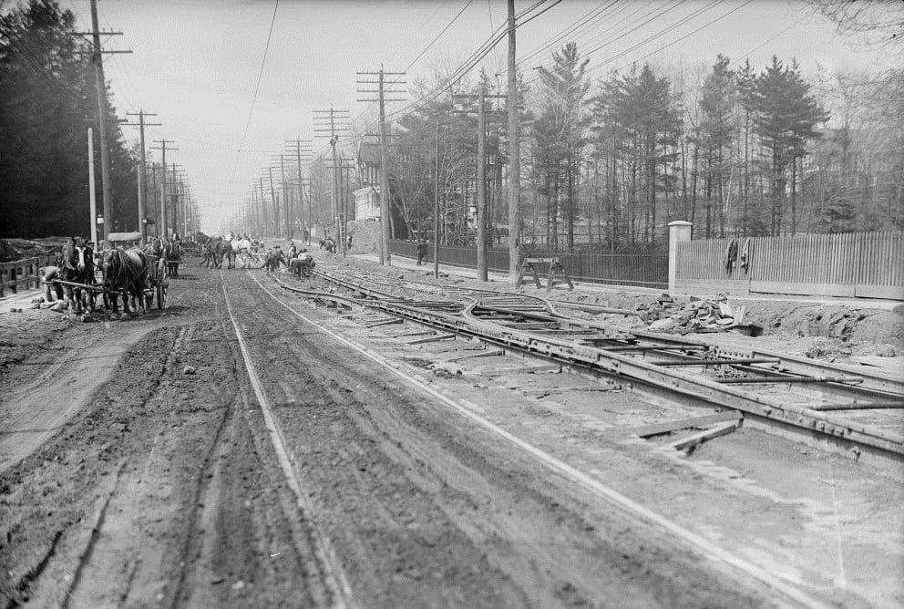
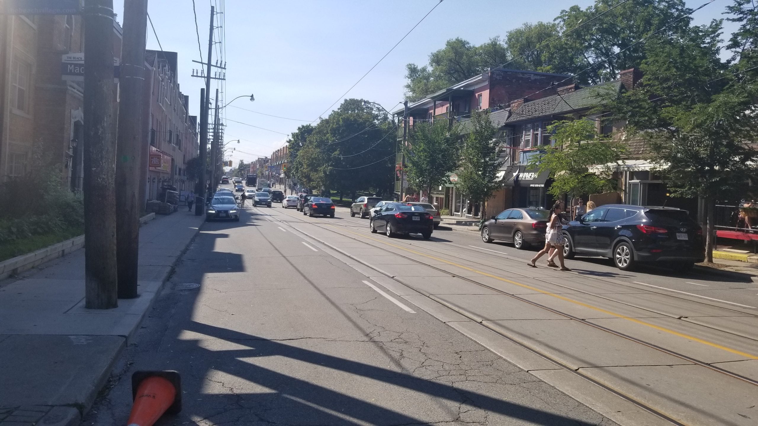
It’s at Queen Street and Maclean Avenue, looking west. The Glen Stewart Ravine used to extend to the lake until the land was more developed into a residential area. The ravine still exists, you can take a beautiful scenic walk all the way from Glen Manor Drive East up to Kingston Road, or it splits and leads over to Balsam Avenue.
2) Even long time residents of this neighbourhood might need a minute to figure out what this building is, as it’s been renovated and expanded, although it still has some very distinct features. This photo is from 1932.
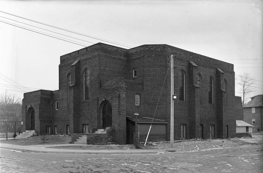
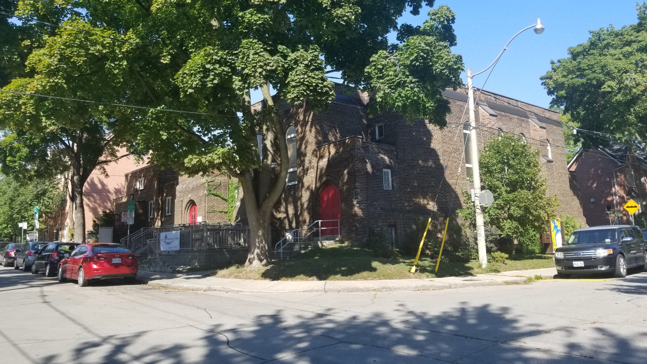
It’s the Beaches Presbyterian Church, just south of Queen Street at Glen Manor Drive and Avion Avenue. One of the biggest changes is the wheelchair accessibility, which continues inside with a lift. The outside remains much the same, although the inside layout has been extensively renovated since the original photo from the 1930s.
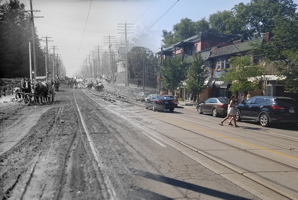
3) This busy intersection has a few clues in it, most notably the buildings on the left and right side – they look virtually the same today as it did in this photo from 1927.
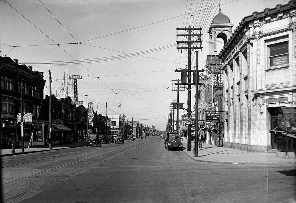
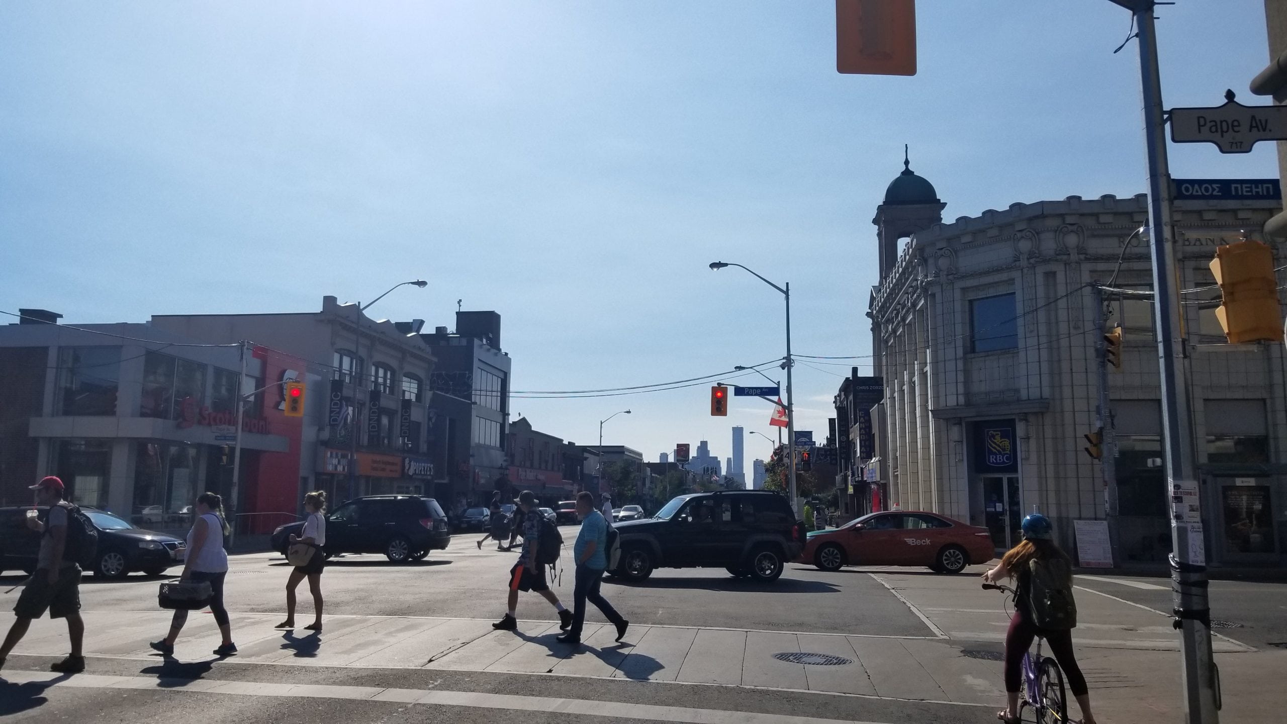
It’s Pape Avenue and Danforth Avenue – the building on the left is home to a few storefronts and the building on the right is now an RBC bank.
4) This last photo from 1926 is of a house that’s tucked away in a popular but quiet neighbourhood in the East End. It may be hard to tell in black and white, but it hasn’t changed a bit!
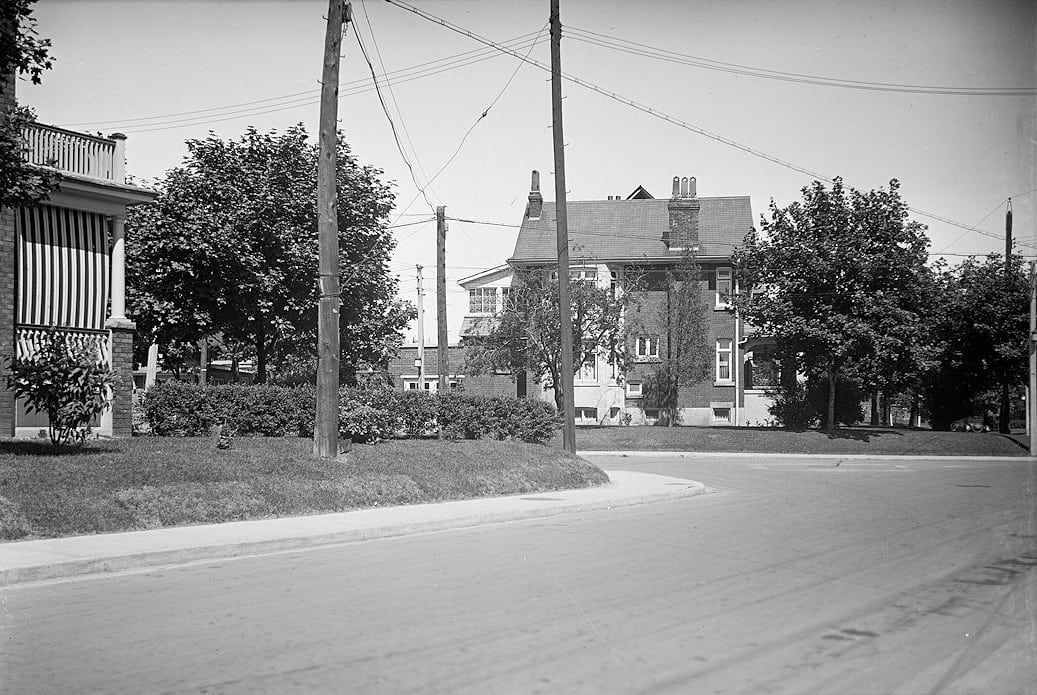
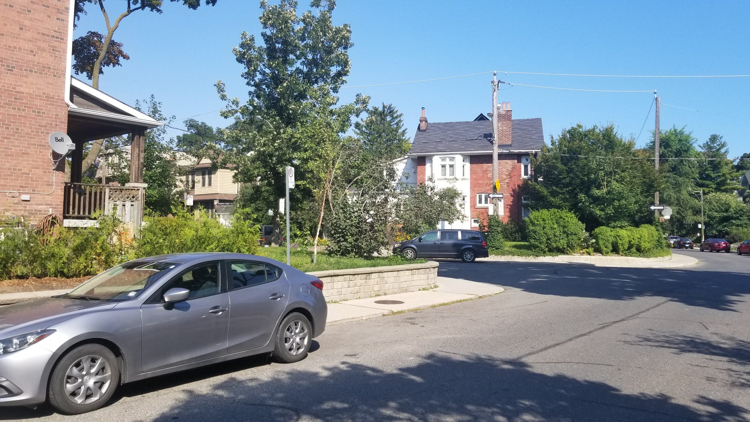
It’s located on the northwest corner of Pretoria Avenue and Ellerbeck Street in Playter Estates.
If you liked this, follow me on Instagram to get updated when I have new posts – next time we will explore the past and present of North Toronto.