Our trip to West Toronto is long overdue! It’s hard to compare landscapes with a blanket of snow and ice but here are a few then and now comparisons. West Toronto is a wonderful, vibrant part of the city to explore, and it has lots of different types of neighbourhoods and homes with different architecture (arts and crafts, Edwardian, Victorian) all coexisting in one area.
OldTO is a website project that collects older photos (from the late 19th century all the way to the 90s) and plots them on a map so you can see how streets in your area and around the city used to look. Here’s some photos from the site that I’ve tried to duplicate to compare views. See if you can figure out where they are from the older photo!
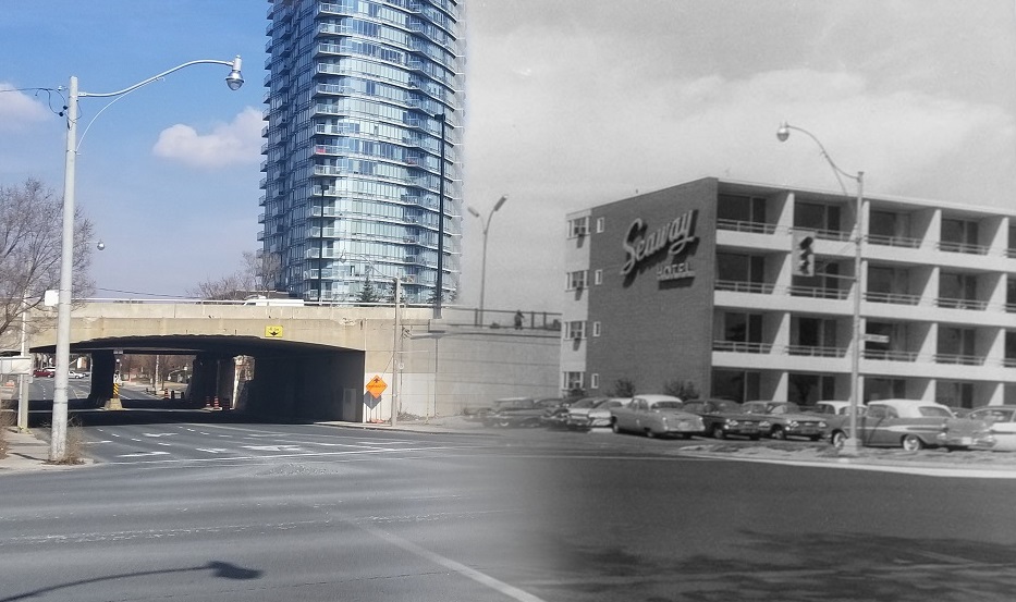
1) This archive photo from the mashup above was taken in 1960 of the Seaway Hotel. It opened in 1955 and won a silver medal from the Massey Medals for Architecture. The design capitalized on the long, narrow lot by taking advantage of the lake views.
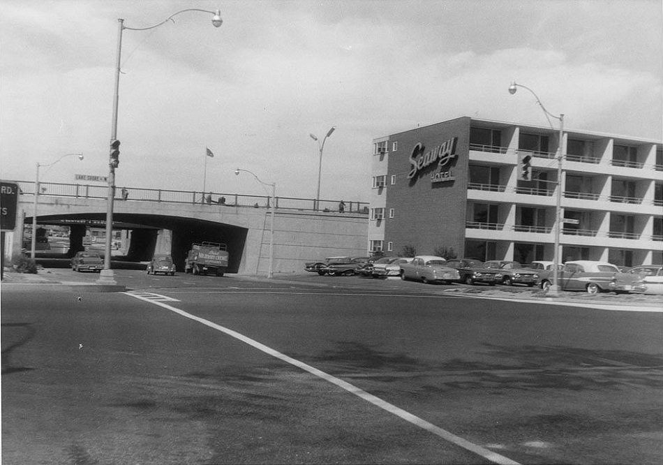
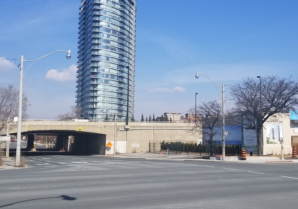
The Seaway Hotel was located at Lake Shore Boulevard and Windermere Avenue, just west of High Park. The hotel was eventually demolished in 1993 to accommodate an on-ramp expansion for the Queen Elizabeth Way (QEW).
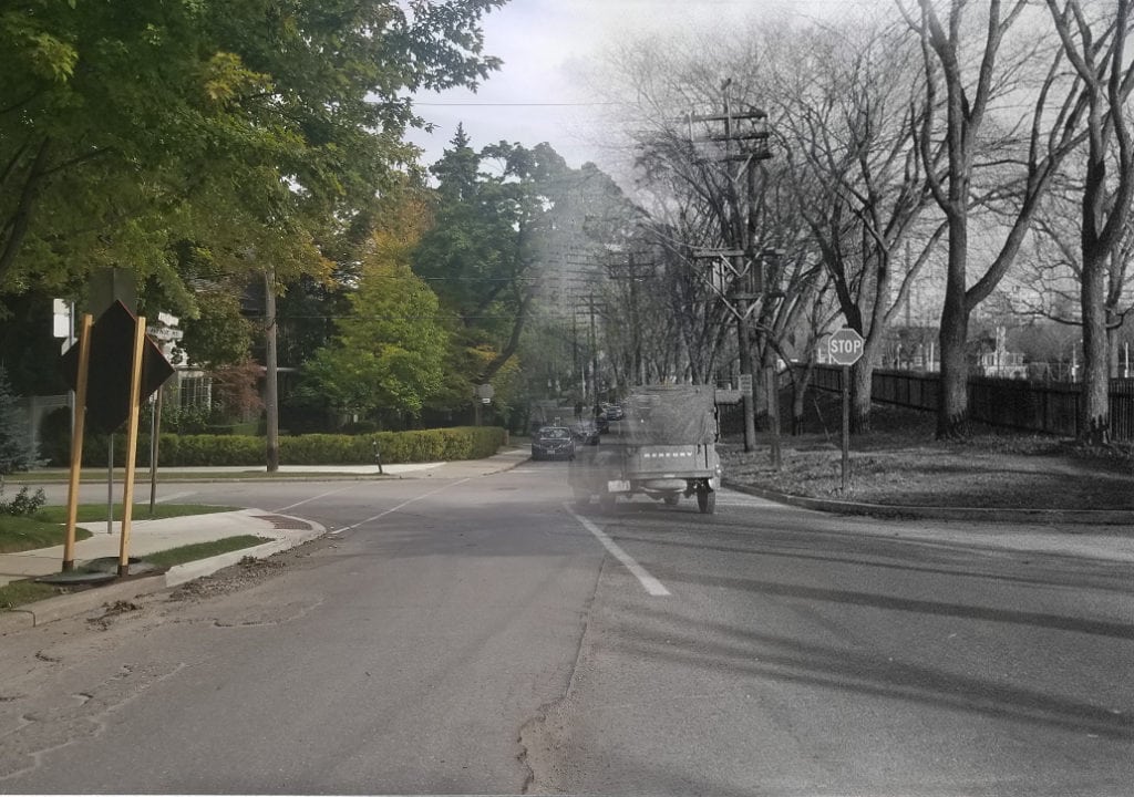
2) This photo from 1959 could be any street in the West end – tree-lined and residential. This particular one-way street is smack in the middle of Roncesvalles Village.
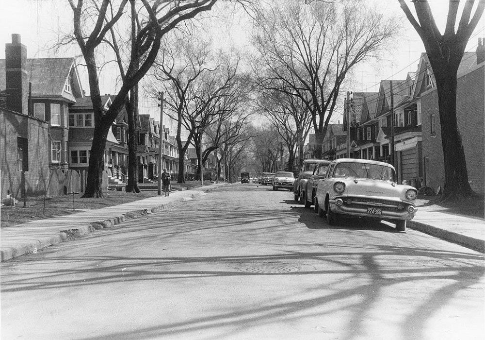
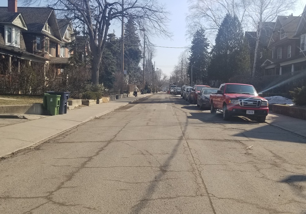
It’s Geoffrey Street, looking east from Roncesvalles Avenue. Lots of the residential streets leading off of Roncesvalles Avenue look very similar.
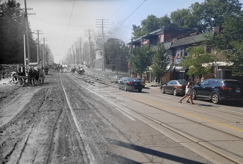
3) This is a photo from 1919, of a house that was just being constructed. It still has the same brick details and layout seen in the “now” photo.
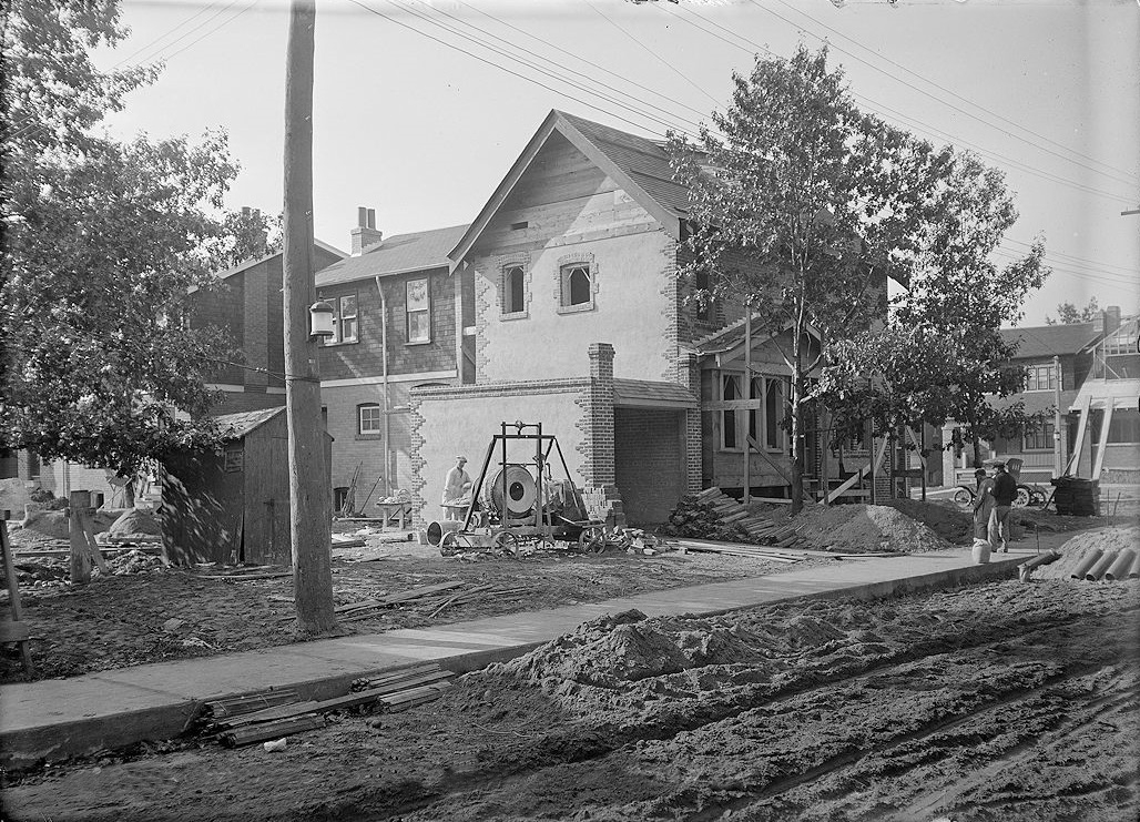
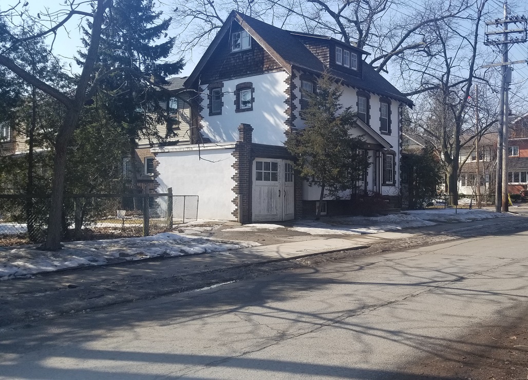
It’s right at Colbeck Street and Beresford Avenue, just north of the Bloor West Village. Strikingly similar!
If you liked this, follow me on Instagram to get updated when I have new posts – next time we will revisit the past and present of Midtown Toronto.